Installation and Maintenance of Real-Time Physical Oceanographic Measurement Stations for the Port of Morgan City
In August 2015 ENCOS, Inc. (ENCOS) was contracted by Morgan City Harbor and Terminal District (MCHTD) for the installation of two met-ocean measurement systems at the Eugene Island Bar Channel on the lower Atchafalaya River
In August 2015 ENCOS, Inc. (ENCOS) was contracted by Morgan City Harbor and Terminal District (MCHTD) for the installation of two met-ocean measurement systems at the Eugene Island Bar Channel on the lower Atchafalaya River. ENCOS’ partner on this project, RPS Group, was responsible for the station design. These systems were installed to the requirements and standards of the National Oceanic and Atmospheric Administration’s (NOAA’s) Physical Oceanographic Real-Time Systems (PORTS®). The system enhances the MCHTD’s management of various activities related to this portion of the Atchafalaya navigation channel including emergency response activities, maritime commerce, and navigation safety. The PORTS® system provides information to the MCHTD management team such as wind speed, wind direction, atmospheric pressure, salinity, water levels, waves, and currents. The management team uses this information to manage and direct assets during an emergency (i.e., oil spills, barge accidents) or natural disasters. The information assists in determining the strategic time for maintenance in the Eugene Island Bar Channel for continued maritime commerce.
ENCOS worked with the NOAA PORTS® survey group and Louisiana State University Center for GeoInformatics Department (LSU CGI) to install a survey grade GPS system on the North Eugene Island water level station. The equipment installed was a Trimble alloy GNSS receiver and a Zephyr 2 GPS antenna. The Trimble alloy is interfaced with a Sierra Wireless Airlink RV 50 cellular modem. The modem and alloy are remotely accessible through a static Internet Protocol (IP) address. LSU CGI processes the data for submission to NOAA in their designated format. This will allow daily correction of water levels to achieve NOAA’s accuracy of 2 cm for navigation.
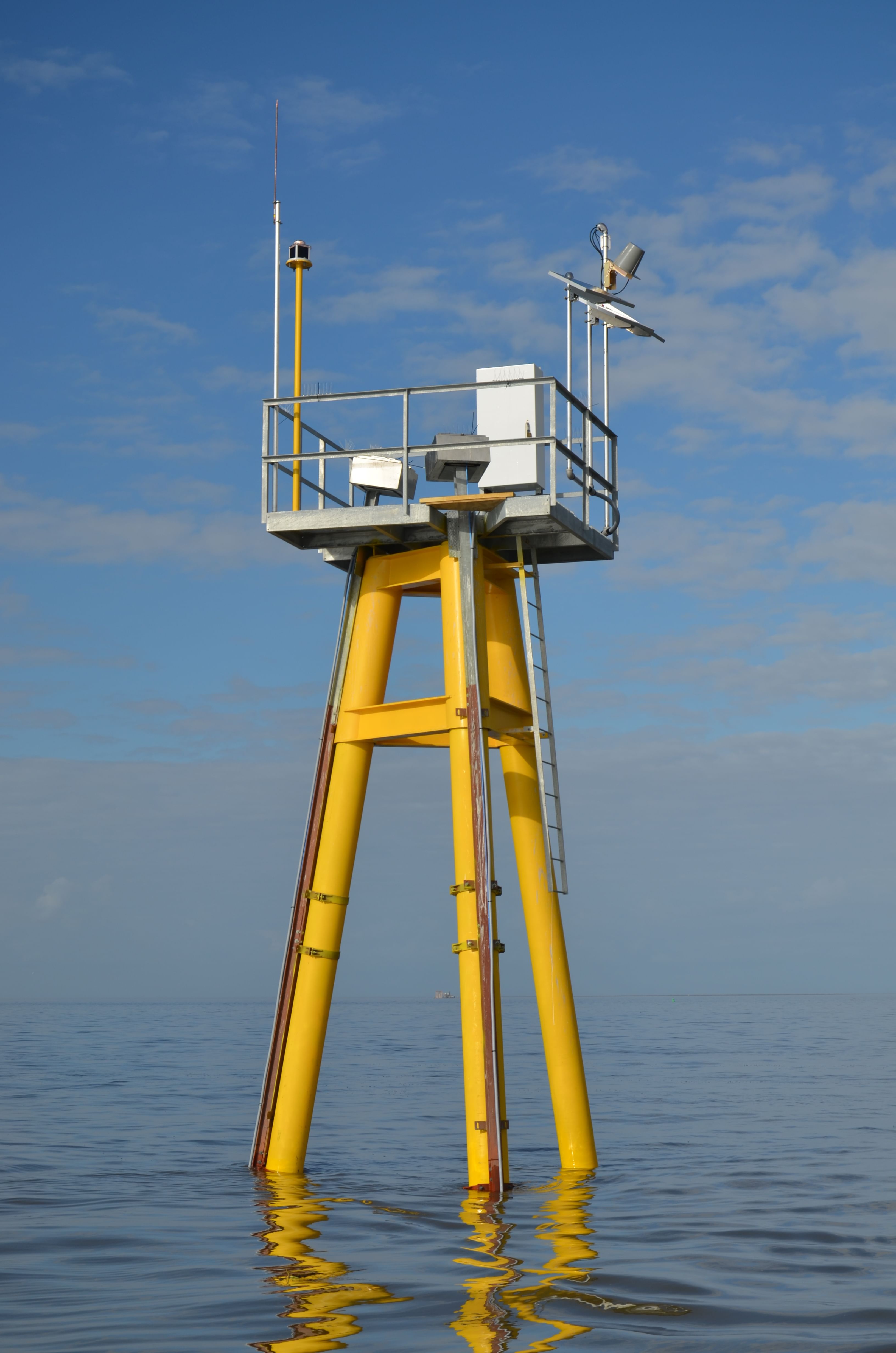
The Eugene Island station (NOAA ID 8764314) has a full suite of meteorological sensors and redundant systems that minimize data gaps to achieve the 95% data completion rate required by NOAA. ENCOS conducts maintenance to the standards and protocols established for the NOAA PORTS® programs. The datalogger used is a highly sophisticated system manufactured and supplied by Sutron Corporation which is a subsidiary of Ott Hydromet and has a proven track record on NOAA PORTS® stations. The other components of the system are primary and redundant RM Young wind sensors, primary and redundant air temperature and relative humidity sensors manufactured by Rotronic, primary radar water level sensor, Sutron Accubar constant flow bubbler as a secondary water level sensor, and a Greenspan specific conductivity and water temperature sensor. The station is fully solar powered with both GOES satellite and back-up cellular communication.
ENCOS and Sutron support work closely to troubleshoot problems either while on site during station maintenance or via remote cellular connection. The NOAA PORTS® station, Atchafalaya Bar Channel (NOAA ID 88764401) located at the Atchafalaya Bar Channel collects current data with a Nortek 400 kHz side looking ADCP, Nortek wave gauge, and a Greenspan specific conductivity and water temperature sensor. The current data is publicly disseminated through the NOAA PORTS® website. Both ADCP’s are attached to separate pilings of the platform and are easily raised to the top of the platform with a solar powered winch and rail system for cleaning and maintenance. The wave gauge and Greenspan data are housed on the Ott Hydromet website and are only available with an administrator issued username and password.