Measuring the Effects of Terrace Construction on Water Flow Through Deep Lake Canal on Paul J. Rainey Wildlife Sanctuary
ENCOS worked in collaboration with the National Audubon Society (NAS) during construction of terraces in nearby open waters to measure what change, if any, would occur to the water flow in the canal.
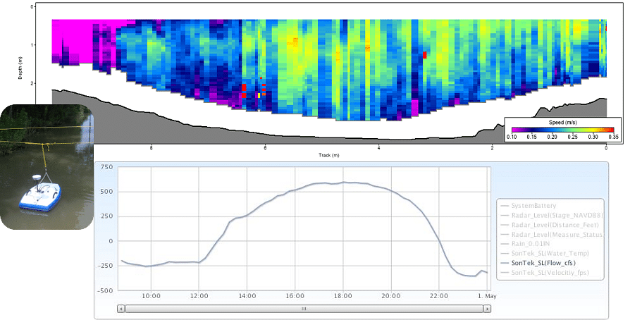
ENCOS worked in collaboration with the National Audubon Society (NAS) during construction of terraces in nearby open waters to measure what change, if any, would occur to the water flow in the canal. The measurements were collected to capture the water flow coming into the canal through two (2) breaches in its banks and quantify water velocities moving through the canal pre and post terrace construction. ENCOS provided the data to NAS to plot and determine what effect the construction of the terraces has on water flow through this canal.
ENCOS installed a horizontal acoustic Doppler current profiler (HADCP) station and three (3) water level stations to provide monthly measurements over a six-month period. The HADCP station, a SonTek 300MhZ HADCP that collected +/- X and Y velocity data, was installed south of two (2) breaches on the main canal conveying water to and from the ponding area where the terrace construction took place. ENCOS and YSI also installed equipment to transfer the station data remotely to YSI’s Storm Central web-based data platform. The data transferred via cell modem were velocity magnitude, flow direction (+/-X), raw and NAVD adjusted water level and water temperature. Additional discharge measurements using a SonTek M9 were conducted to verify the accuracy of the data collected by the HADCP. This station remained operational until the stations were removed in June of 2020. Stations and HADCP locations were selected and placed in strategic locations should NAS decide to build a hydraulic or hydrologic model of this area in the future